APRS Station Locator, Weather Conditions
and APRS Activity Maps
This page loads a lot of images, please be patient, especially if on dial-up connections.
Position reports provided by servers at: Google,
findu.com, and WinLink.org
Search scripts below were adapted from Steve Dimse, K4HG's findu.com cgi page.
Some Canadian locations will have the photos/maps available even though it states US only!
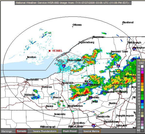
Radar maps will appear if within range of an US NWS NEXRAD radar station.
APRS MAP PROVIDERS
Google
Maps and Google
Earth by Google
Radar maps from NWS NEXRAD
Maps by MapQuest, Microsoft
Bing Maps, aprsworld mapserver
National Resources Canada Topographical maps
(English)
(francais)
NOTE: Depending on the state of the internet and of the APRS
Severs, position reports may be some time behind real time reporting as seen
over the airwaves. Depending on individual station setup parameters, the
station may not be seen by the APRS server, or if the station is
closed down (mobile/base) it will not be seen after a set time. Mobile
stations may not be in range of another APRS station to rebroadcast their
position reports.
Search for and Display APRS Stations
Enter a callsign into the search box that is
displaying the type of display results you wish to view, then click on the
"Find" button. Some will accept more than one call
separated by commas.
Click on thumbnail images to see a representative full size image.
Click on an option to see its graphic representation where available.
Search by:
- APRS station:
- using Google Maps APRS (aprs.fi)
- using findu.com
- K6IB's 3D View Auto Tracker
- K6IB's 3D View Auto Update Tracker
- K6IB's 3D APRS IRLP Monitor
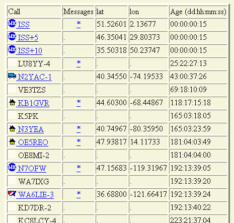
- APRS Stations near a Lat/Long
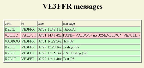
- messages to/from Station
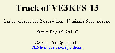
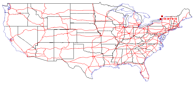
- track on USA map
- digipeating through the ISS
- APRS Weather Station:
To top of this page
Find an APRS station using Google Maps APRS (aprs.fi)
To see multiple APRS stations using Google
Maps APRS click here
or enter a call sign below:
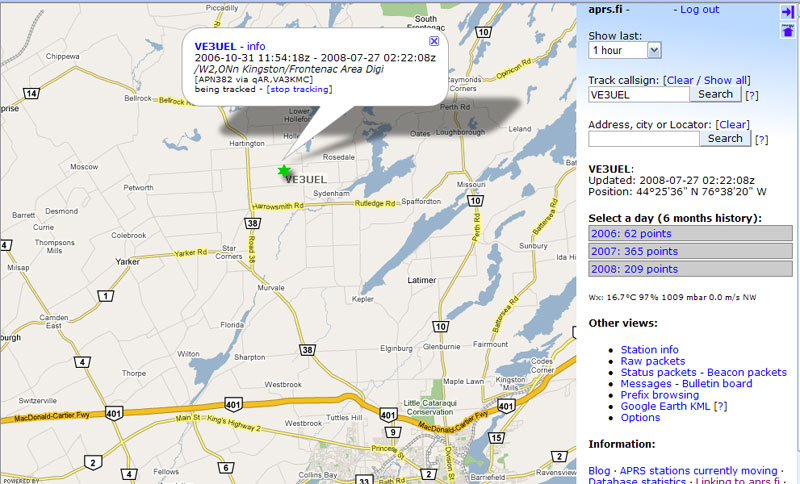
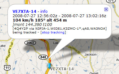
Options of Raw, Status, Beacon packets, messages, bulletin board, and live tracking in Google Earth
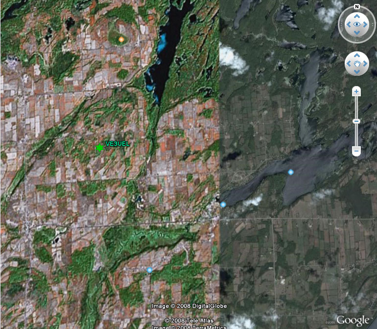
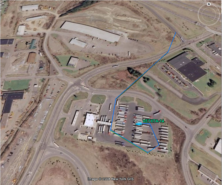
Google Earth Live tracking.
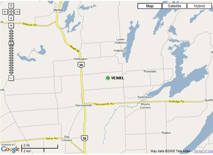
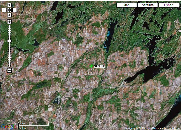
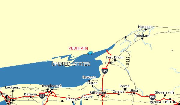
On the left VE3UEL showing the differences of resolution depending on the area in Canada. Just to the east the resolution is great but not at VE3UEL.
Map at this point is not fully zoomed in. On the right is a shot of VE7XTA in NY.
Raw Data
Google Map Satellite Map

Hybrid (Sat with streets) Nexrad Weather
Options of aerial photo, topo map, QRZ lookup of call sign
Find an APRS station using K6IB's 3D View Auto Tracker
and see what a mobile sees
Read instructions - requires a plugin
3D View Auto Tracker
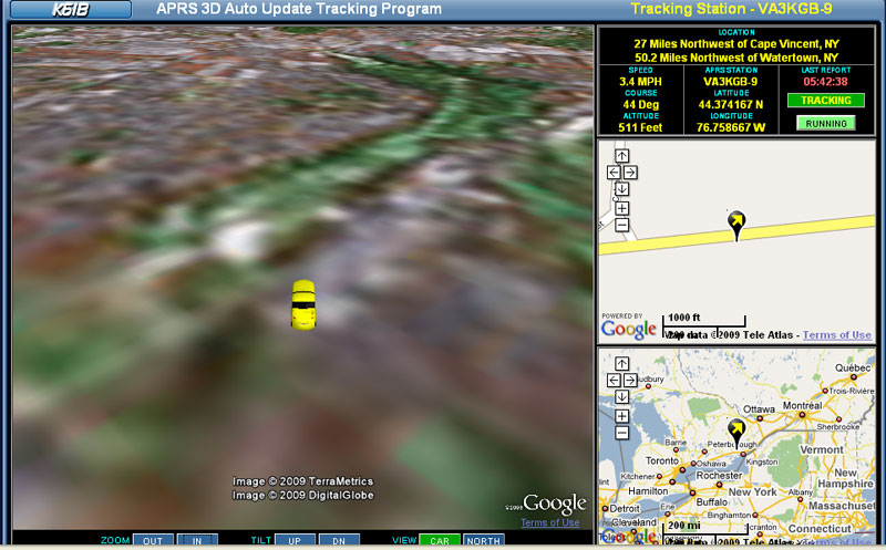
(Map, Satellite, and Hybrid views)
Track a mobile station using K6IB's Auto Update Tracker
Click above for custom setup
(1 map, 2 maps, and choose icon)


(Map, Satellite, and Hybrid views)
K6IB's APRS IRLP Monitor
Monitoring of IRLP Nodes that are sending APRS IRLP object information.
Monitor runs for 15 mins then click on Restart button to continue
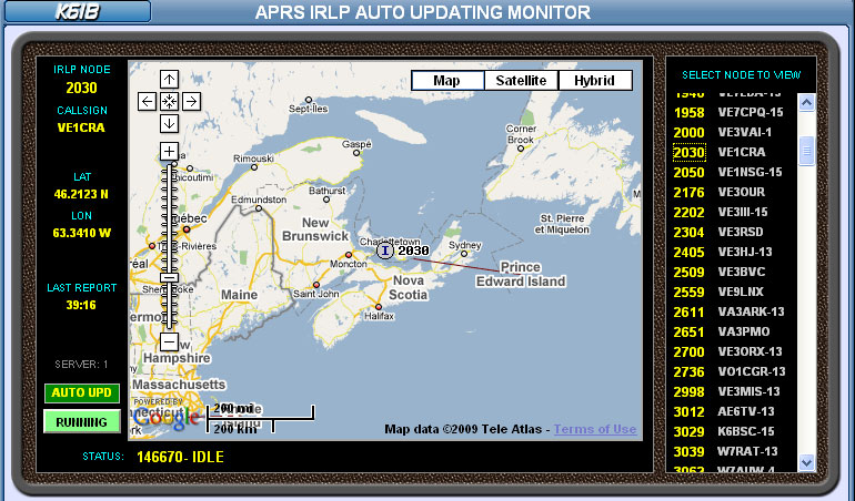
(Map, Satellite, and Hybrid views)

Options: Station location, QRZ lookup, messages, weather,
maps showing nearby stations: Toporama map1, map 2,
and aprsworld map
aprsworld maps and MapPoint map
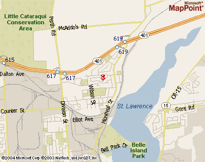
Options: nearby stations, topo map
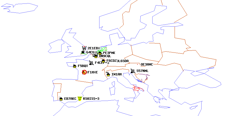
Maps show stations using the ISS and current position of ISS
along with positions in 5 and 10 minutes
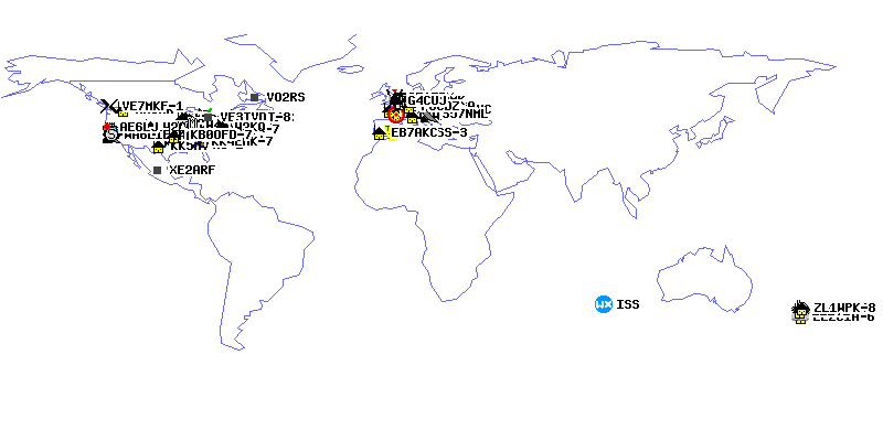
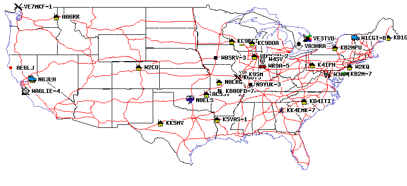
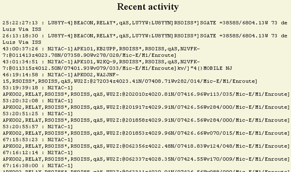
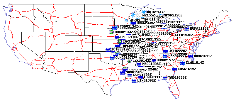
Recent Activity
Options: Station location, messages
To top of this page
Displays the current conditions of a weather station, four graphs of the historical weather data and a wx radar map. (findu.com)
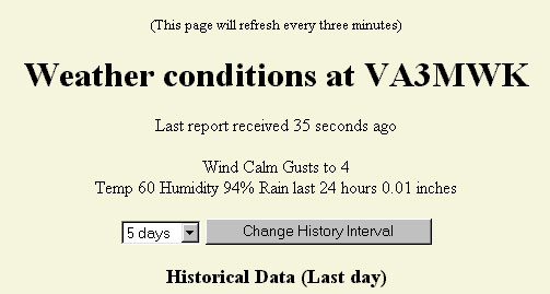


Temperature - - - - - - - Wind - - - - - - - Barometer - - - - - - - Rain - - -
NWS NEXRAD radar map
This displays the NWS messages near a given location. If call=* is used then the page will show all warnings and they will be sorted by time received. (aprsworld maps)
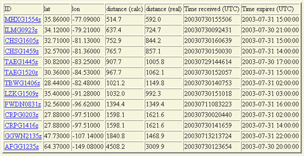
Option: Weather Warning text, view example as text, as graphic image
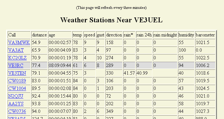
Option: Station weather history
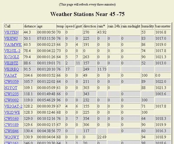
Option: Station weather history
To top of this page