APRS MAPS
MANITOBA
APRS Map Main Index
Manitoba Provincial Area Maps
Manitoba City Maps
How to Use maps for APRS Programs
MANITOBA PROVINCIAL AREA MAPS
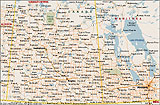
Southern Manitoba (VE3ADJ)

smb.zip, 20000605, 0121K, (.map)
Southern Manitoba (VE3ADJ)

smb1.zip, 20010217, 0121K, (.map)
Southern Manitoba (VE7BZC), 2005

6-0-MB-Manitoba-South_U.zip, 237KB, (.png, .inf)
6-0-MB-Manitoba-South_W.zip, 112KB, (.gif, .geo)
6-0-MB-Manitoba-South_X.zip, 112KB, (.gif, .geo)
Saskatchewan & Manitoba
SaskMan.zip, (bmp,gif,geo,inf), 114 KB
MANITOBA CITY MAPS
Winnipeg (VE7BZC)

MB-Winnipeg_U.zip, 1.08MB, (.png, .inf)
MB-Winnipeg_W.zip, 454KB, (.gif, .geo)
MB-Winnipeg_X.zip, 454KB, (.gif, .geo)
Winnipeg 50km
WINNIPEG 50km.zip, (gif,geo,inf), 30 KB
Winnipeg 100km
WINNIPEG 100km.zip, (gif,geo,inf), 25 KB
Winnipeg 200km
WINNIPEG 200km.zip, (gif,geo,inf), 31 KB
To top of this page