APRS Maps
Ontario
APRS Map Main Index
Ontario Provincial Area Maps
Ontario City Maps
How to Use maps for APRS Programs
ONTARIO PROVINCIAL AREA MAPS
Counties of Ontario for CANWARN
counties.zip, 19990404, 14K, (.map)
(separate maps - unzip to WinAPRS\counties\on)
Contour and Elevation of Southern Ont, (VE3ADJ)

demsont.zip, 20000128, 72 KB, (gif,geo)
Northern Ontario (VE3ADJ)

nontc.zip, 20000423, 157K, (.map)
(works well when overlaid with sont)
Southern Ontario with dark highway lines, (VE3ADJ)

sontc5c.zip, 20001222, 385K, (.map)
Southern Ontario (Ottawa streets shown), (VE3ADJ)

sontc5co.zip, 20001222, 641K, (.map)
Southern Ontario with light highway lines, (VE3ADJ)

sontc5n.zip, 20000128, 379K, (.map)
Ontario-Quebec (extended to E and S) (VE3ADJ)

sonpq5a.zip, 20000128, 408K, (.map)
Ontario-Quebec (extended to E and S, light hwys) (VE3ADJ)

sonpq5an.zip, 20000128, 408K, (.map)
Ontario (VE7BZC), 2005

6-1-ON-Ontario_U.zip, 644KB, (.png, .inf)
6-1-ON-Ontario_W.zip, 254KB, (.gif, .geo)
6-1-ON-Ontario_X.zip, 254KB, (.gif, .geo)
Quebec-Ontario-Labrador

qo.zip, 19980218, 213K, (.map)
Barrie ON to Buffalo NY (VA3BOO)

Barrie2Buffalo.zip, 24 kb
Barrie - Peterbourough - St Catherines (VE7BZC), 2004

ON-Ontario-Barrie-Peterboro-StCatherines_U.zip, 685KB, (.png, .inf)
ON-Ontario-Barrie-Peterboro-StCatherines_W.zip, 264KB, (.gif, .geo)
ON-Ontario-Barrie-Peterboro-StCatherines_X.zip, 264KB, (.gif, .geo)
Bath to Gananoque (VA3BOO)

Bath2Gan.zip, 21 kb
Beaurivage Island aerial photo (VA3BOO)

beaurivage_aerial.zip, 708 kb
Belleville to Gananoque (VA3BOO)

Bellville2Gan.zip, 16.4 kb
Brighton to Lancaster (VA3BOO)

bright2lanc.zip, 50.4 kb
Brockville - Kingston - Watertown,NY (VE7BZC), 2004

ON-Ontario-Brockville-Kingston-Watertown_U.zip, 482KB, (.png, .inf)
ON-Ontario-Brockville-Kingston-Watertown_W.zip, 184KB, (.gif, .geo)
ON-Ontario-Brockville-Kingston-Watertown_X.zip, 184KB, (.gif, .geo)
Camelot Island to Canoe Point (VA3BOO)

camelot2canoe.zip, 1.46 MB
Code Corners to Joyceville (VA3BOO)

code2joycevile.zip, 15.6 kb
Collingwood - Wasaga Beach
Collingwood - Wasaga Beach.zip, (bmp,gif,geo,inf), 106 KB
Interstate 81 from Canada to Watertown NY (VA3BOO)
Can-Watertwn.zip, 19.8 kb
Eastern Ontario (VE3BSM)

Eastern Ontario_U.zip, 166KB, (.png, .inf)
Eastern Ontario_W.zip, 166KB, (.png, .geo)
Eastern Ontario_X.zip, 166KB, (.png, .geo)
North East US (VE3BSM)

NorthEastUS_U.zip, 161KB, (.png, .inf)
NorthEastUS_W.zip, 161KB, (.png, .geo)
NorthEastUS_X.zip, 161KB, (.png, .geo)
Lake Ontario (VE3GSI)

uilakeont.zip, 20010102, (bmp,gif,inf), 158 KB
w_uilakeont.zip, (gif,geo), 82 KB
Eastern Ontario (VA3BOO)

E_Ontario.zip, 19.1 kb
North West Ontario (VE3BSM)

North West Ontario_U.zip, 110KB, (.png, .inf)
North West Ontario_W.zip, 110KB, (.png, .geo)
North West Ontario_X.zip, 111KB, (.png, .geo)
South-Western Ontario (VE3GSI)
uiswont.zip, 20010204, (bmp,inf), 203 KB
w_uiswont.zip, (gif,geo), 227 KB
South-Western Ontario
ontario.zip, (gif,geo,inf), 192 KB
South-Central Ontario
South-Central Ontario.zip, (gif,geo,inf), 33 KB
Southern Ontario
Southern Ontario.zip, (gif,geo,inf), 42 KB
Southern Ontario - 100km
Southern Ontario -100k.zip, (gif,geo,inf), 62 KB
Southern Ontario-New
Southern Ontario-New.zip, (gif,geo,inf), 55 KB
Southern Ontario - Northern New York - Westerm Michigan (VE3BSM)

SON_NNY_WMI_U.zip, 112KB, (.png, .inf)
SON_NNY_WMI_W.zip, 112KB, (.png, .geo)
SON_NNY_WMI_X.zip, 112KB, (.png, .geo)
401 to Tillsonburg & Port Burwell
401 to Port Burwell.zip, (bmp,geo,gif,inf), 102 KB
Brantford, Cambridge, Hamilton area
Bfd-Ham-Cam.zip, (gif,geo,inf), 38 KB
Coburg to Kingston (VE3GSI)

uicob2king.zip, 20010102, (bmp,gif,inf), 224 KB
w_uicob2king.zip, (gif,geo), 106 KB
Gananoque to Brockville (VA3BOO)

gan2brock.zip, 22 kb
Gananoque to Gordon Island (VA3BOO)
gan2gordon.zip, 1.19 MB
Gananoque to Montreal (VA3BOO)

gan2montl.zip, 28.3 kb
Gananoque to Montreal (VA3BOO)

Gan2Mtl.zip, 28.4 kb
Gananoque Region Topographical map (VA3BOO)

Topo_Gan_Region.zip, 791 kb
Kingston NW Topographical map (VE3NWV)

ui_Kingston_Loc_NW.zip, 336 kb
Kingston - VNC KNE aeronautical chart (VE3NWV)

ui_vncKNE.zip, 6.2 mb
Kingston - VNC KNW aeronautical chart (VE3NWV)

ui_vncKNW.zip, 6.65 mb
Kingston - VNC KNW25 aeronautical chart (VE3NWV)

ui_vncNW25.zip, 6.84 mb
Kingston to Gananoque (VA3BOO)

gan2king.zip, 22.1 kb
Kingston to Gananoque (VA3BOO)

k2gan_new.zip, 34.4 kb
Kingston to Gananoque 50km (VA3BOO)

k2gan50K.zip, 34.2 kb
Kingston to Montreal (VA3BOO)

king2mtl.zip, 64.4 kb
Lanark (VE3BSM)

Lanark_U.zip, 180KB, (.png, .inf)
Lanark_W.zip, 180KB, (.png, .geo)
Lanark_X.zip, 180KB, (.png, .geo)
Lanark Highlands (VE3BSM)

LanarkHighlands_U.zip, 178KB, (.png, .inf)
LanarkHighlands_W.zip, 179KB, (.png, .geo)
LanarkHighlands_X.zip, 179KB, (.png, .geo)
Leek Island to Niagara Island (VA3BOO)

Leek2niagra_topo.zip, 1.25 MB
London to Woodstock
London to Woodstock.zip, (bmp,gif,geo,inf), 192 KB
Middle Road to Gananoque (VA3BOO)

mid_gan.zip, 24.1 kb
Niagara Falls Area (ON/NY)
Niagara.zip, (bmp,gif,geo,inf), 98 KB
North Grenville (VE3BSM)

North Grenville_U.zip, 127KB, (.png, .inf)
North Grenville_W.zip, 127KB, (.png, .geo)
North Grenville_X.zip, 127KB, (.png, .geo)
Ottawa to Montreal (VE3GSI)
uiott2mont.zip, 20010104, (bmp,inf), 233 KB
w_uiott2mont.zip, (gif,geo), 236 KB
Ottawa - Cornwall (VE7BZC), 2004
ON-Ontario-Ottawa-Cornwall_U.zip, 630KB, (.png, .inf)
ON-Ontario-Ottawa-Cornwall_W.zip, 241KB, (.gif, .geo)
ON-Ontario-Ottawa-Cornwall_X.zip, 241KB, (.gif, .geo)
Parry Sound - Barrie (VE7BZC), 2004

ON-Ontario-ParrySound-Barrie_U.zip, 469KB, (.png, .inf)
ON-Ontario-ParrySound-Barrie_W.zip, 207KB, (.gif, .geo)
ON-Ontario-ParrySound-Barrie_X.zip, 207KB, (.gif, .geo)
Perth - Smith Falls (VE3BSM)

Perth-SFalls_U.zip, 72KB, (.png, .inf)
Perth-SFalls_W.zip, 72KB, (.png, .geo)
Perth-SFalls_X.zip, 72KB, (.png, .geo)
Prescott to Cornwall (VA3BOO)

Prescott_Cornwall.zip, 103 kb
Bay of Quinte (VE3GSI)
uiquinte.zip, 20010102,(bmp,gif,inf), 258 KB
w_uiquinte.zip, (gif,geo), 122 KB
South Georgian Bay
South Georgian Bay.zip, (bmp,gif,geo,inf), 68 KB
Toronto-Kitchener-Hamilton
MISS.zip, (gif,geo,inf), 113 KB
Toronto 50 (VE3BSM)

TRNT050_U.zip, 88KB, (.png, .inf)
TRNT050_W.zip, 88KB, (.png, .geo)
TRNT050_X.zip, 88KB, (.png, .geo)
Toronto 120 (VE3BSM)

TRNT120_U.zip, 71KB, (.png, .inf)
TRNT120_W.zip, 72KB, (.png, .geo)
TRNT120_X.zip, 72KB, (.png, .geo)
West Carleton (VE3BSM)

West Carleton_U.zip, 155KB, (.png, .inf)
West Carleton_W.zip, 155KB, (.png, .geo)
West Carleton_X.zip, 155KB, (.png, .geo)
Windsor-Chatham 60 Miles
Windsor-Chatham 60 Miles.zip, (gif,geo,inf), 38 KB
Windsor-London 150 Miles
Windsor-London 150 Miles.zip, (gif,geo,inf), 82 KB
Windsor-Toronto 230 Miles
Windsor-Toronto 230 Miles.zip, (gif,geo,inf), 105 KB
Woodstock to Paris
Woodstock to Paris.zip, (bmp,gif,geo,inf), 64 KB
To top of this page
ONTARIO CITY MAPS
Almonte (VE3ADJ)

almonte.zip (gif,geo), 19990427, 56K
Almonte (VE3BSM)

Almonte_U.zip, 94KB, (.png, .inf)
Almonte_W.zip, 95KB, (.png, .geo)
Almonte_X.zip, 95KB, (.png, .geo)
Almonte - Carleton Place (VE3BSM)

Almonte-CP_U.zip, 87KB, (.png, .inf)
Almonte-CP_W.zip, 87KB, (.png, .geo)
Almonte-CP_X.zip, 87KB, (.png, .geo)
Arnprior (VE3ADJ)

arnprior.zip, (gif,geo), 19990407, 51K
Belleville (VE3ADJ)

bellevil.zip, (gif,geo),19990726, 146K
Belleville (VE3GSI)

uibelleville.zip, (bmp,gif,inf), 171 KB
w_uibelleville.zip, (gif,geo), 87 KB
Belleville - Trenton
Bell-Trent.zip, (gif,geo,inf), 37 KB
Brantford
BRANTFOR.zip, (gif,geo,inf), 62 KB
Brantford
Brantford1.zip, (gif,geo,inf), 36 KB
Brantford- 250 metre
Brantford-250m.zip, (bmp,gif,geo,inf), 440 KB
Brockville (VE3ADJ)

brockvil.zip, (gif,geo), 19990404, 90K
Brockville (VE3BSM)

Brockville_U.zip, 92KB, (.png, .inf)
Brockville_W.zip, 92KB, (.png, .geo)
Brockville_X.zip, 92KB, (.png, .geo)
Cambridge
Cambridge.zip, (bmp,gif,geo,inf), 170 KB
Carleton Place (VE3ADJ)
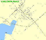
carleton.zip, (gif,geo), 19990323, 57K
Chatham and Wallaceburg (VE3GSI)

uichatham.zip, (bmp,inf), 20010204, 94 KB
w_uichatham.zip, (gif,geo), 89 KB
Cornwall (VE3ADJ)
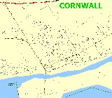
cornwall.zip, (gif,geo), 19990404, 103K
Cumberland (VE3ADJ)

cumber.zip, (gif,geo), 19990404, 103K
Dundas
DUNDAS.zip, (gif,geo,inf), 67 KB
Gananoque (VA3BOO)

Gan0002.zip, 12.8 kb
Gananoque Geographical Area (VA3BOO)

gan_geo_area.zip, 1.34 MB
Gananoque topographical Town map (VA3BOO)

Gan_Topo_Town_Map.zip, 962 kb
Gananoque St Lawrence River (VA3BOO)

RiveratGan20k.zip, 16.9 kb
Gananoque St Lawrence River (VA3BOO)

riverchart.zip, 633 kb
Gananoque St Lawrence River (VA3BOO)

riverchart_new.zip, 4.84 MB
Gananoque St Lawrence River (VA3BOO)

riverchart2.zip, 347 kb
Georgetown

georgetn.zip, (gif,geo), 19990620, 41kb
Glenvale Station (VA3BOO)

Glenvale_Station_Topo.zip, 1.15 MB
Gordon Island (VA3BOO)

Gordon_Island.zip, 1.45 MB
Gordon Island to Stave Island (VA3BOO)

gordon2stave.zip, 1.33 MB
Hamilton

hamilton.zip, (gif,geo), 19990221, 275kb
Hamilton - 5km
HAMILTON - 5K.zip, (gif,geo,inf), 79 KB
Hamilton (VA3BOO)

hamilton.zip, 43.9 kb
Howe Island (VA3BOO)

Howe_Is.zip, 14.2 kb
Ivy Lea aerial photo (VA3BOO)
IvyLea_aerial.zip, 373 kb
Ivy Lea river chart (VA3BOO)

ivyleariver_chart.zip, 7.35 MB
Jones Falls (VA3BOO)

jonesfalls.zip, 13.3 kb
Joyceville (VA3BOO)

Joyceville.zip, 15.1 kb
Joyceville Penitentiary (VA3BOO)
Joyceville_Pen.zip, 6.33 kb
Kanata North (VE3BSM)

Kanata North_U.zip, 70KB, (.png, .inf)
Kanata North_W.zip, 70KB, (.png, .geo)
Kanata North_X.zip, 70KB, (.png, .geo)
Kanata South (VE3BSM)

Kanata South_U.zip, 81KB, (.png, .inf)
Kanata South_W.zip, 81KB, (.png, .geo)
Kanata South_X.zip, 81KB, (.png, .geo)
Kemptville (no street names) (VE3ADJ)

kemptvil.zip, (gif,geo), 19990608, 85K
Kemptville 1 (VE3BSM)

Kemptville1_U.zip, 91KB, (.png, .inf)
Kemptville1_W.zip, 91KB, (.png, .geo)
Kemptville1_X.zip, 91KB, (.png, .geo)
Kemptville 2 (VE3BSM)

Kemptville2_U.zip, 76KB, (.png, .inf)
Kemptville2_W.zip, 76KB, (.png, .geo)
Kemptville2_X.zip, 76KB, (.png, .geo)
Kingston (VE3ADJ)

kingston.zip, (gif,geo), 20000128, 128K
Kingston (VE3GSI)

uikingston.zip, (bmp,gif,inf), 256 KB
w_uikingston.zip, (gif,geo), 130 KB
Kingston Area (VA3BOO)

kingarea.zip, 19.8 kb
Kingston Airport CYGK (VE3NWV)

ui_cygk.zip, 406 kb
Kingston - Collins Bay Road (VA3BOO)

collinsb.zip, 33.1 kb
Kingston Downtown (VA3BOO)

kingdtw.zip, 45.5 kb
Kingston Downtown (VA3BOO)

Kingston_Downtown.zip, 30.8 kb
Kingston Downtown (VA3BOO)

Kingston_DT.zip, 29.3 kb
Kingston West (VA3BOO)

kingwest.zip, 44.2 kb
Greater Kingston (VA3BOO)

Greater_Kingston.zip, 16.7 kb
Greater Kingston Topographical map (VE3NWV)

ui_GreaterKingstonTopo.zip, 229 kb
Kingston East Topographical map (VE3NWV)
ui_Kingston_Loc_East.zip, 364 kb
Kitchener 20km
kitchener 20km.zip, (gif,geo,inf), 63 KB
Kitchener 50km
Kitchener 50km.zip, (gif,geo,inf), 35 KB
Leek Island aerial photo (VA3BOO)
leek_aerial.zip, 958 kb
Lindsay Island aerial photo (VA3BOO)

lindsay_is_aerial.zip, 708 kb
London
LON.zip, (gif,geo,inf), 58 KB
London
LON1.zip, (gif,geo,inf), 54 KB
London
LON2.zip,(gif,geo,inf), 114 KB
London
London.zip, (bmp,gif,geo,inf), 223 KB
Mermaid Island aerial photo (VA3BOO)

mermaid_aerial.zip, 707 kb
Napanee (VE3ADJ)

napanee.zip, (gif,geo), 19990727, 68K
Napanee (VE3GSI)

uinapanee.zip, (bmp,gif,inf), 107 KB
w_uinapanee.zip, (gif,geo), 54 KB
Niagara Island (VA3BOO)

Niagara_Island.zip, 1.45 MB
Oshawa (VE3ADJ)

oshawa.zip, (gif,geo), 19990221, 207kb
Ottawa (VE3GSI)

uiottawa.zip, (bmp,gif,inf), 20010102, 751 KB
w_uiottawa.zip, (gif,geo) ,386 KB
Ottawa (VE3GSI)

uiottawa2.zip, (bmp,gif,inf), 20010104, 365 KB
w_uiottawa.zip, (gif,geo), 399 KB
Ottawa central (VE3ADJ)
ottawa.zip, (gif,geo), 19990319, 527K
Ottawa Center (VE3BSM)

Ottawa Center_U.zip, 299KB, (.png, .inf)
Ottawa Center_W.zip, 299KB, (.png, .geo)
Ottawa Center_X.zip, 299KB, (.png, .geo)
Ottawa East (VE3BSM)

Ottawa East_U.zip, 135KB, (.png, .inf)
Ottawa East_W.zip, 135KB, (.png, .geo)
Ottawa East_X.zip, 135KB, (.png, .geo)
Ottawa - Parliament Area (VE7BZC)

ON-Ottawa-Parliament Area_U.zip, 737KB, (.png, .inf)
ON-Ottawa-Parliament Area_W.zip, 253KB, (.gif, .geo)
ON-Ottawa-Parliament Area_X.zip, 253KB, (.gif, .geo)
Ottawa South 1 (VE3BSM)

Ottawa South 1_U.zip, 146KB, (.png, .inf)
Ottawa South 1_W.zip, 147KB, (.png, .geo)
Ottawa South 1_X.zip, 147KB, (.png, .geo)
Ottawa South 2 (VE3BSM)

Ottawa South 2_U.zip, 80KB, (.png, .inf)
Ottawa South 2_W.zip, 81KB, (.png, .geo)
Ottawa South 2_X.zip, 81KB, (.png, .geo)
Ottawa West 1 (VE3BSM)

Ottawa West 1_U.zip, 112KB, (.png, .inf)
Ottawa West 1_W.zip, 112KB, (.png, .geo)
Ottawa West 1_X.zip, 112KB, (.png, .geo)
Ottawa West 2 (VE3BSM)

Ottawa West 2_U.zip, 72KB, (.png, .inf)
Ottawa West 2_W.zip, 72KB, (.png, .geo)
Ottawa West 2_X.zip, 72KB, (.png, .geo)
Ottawa Wide (VE3BSM)

Ottawa Wide_U.zip, 215KB, (.png, .inf)
Ottawa Wide_W.zip, 215KB, (.png, .geo)
Ottawa Wide_X.zip, 215KB, (.png, .geo)
Greater Ottawa with white background (VE2AW)
go2-1wb.zip, 19980218, 518K, (.map)
Greater Ottawa with yellow background (VE2AW)

go2-1ns.zip, 19980218, 212K, (.map)
Greater Ottawa Overlay (use with the S Ont maps) New Version (VE3ADJ)

go_o_lay.zip, 20000917, 259K, (.map)
Ottawa - VNC YOW aeronautical chart (VE3NWV)

ui_vncYOW.zip, 6.62 mb
Ottawa-Hull (VE3ADJ)

ottawag.zip, (gif,geo), 19990413, 470K
Parry Sound (VE7BZC), 2004
ON-ONTARIO-PARRYSOUND_U.zip, 209KB, (.png, .inf)
ON-ONTARIO-PARRYSOUND_W.zip, 105KB, (.gif, .geo)
ON-ONTARIO-PARRYSOUND_X.zip, 105KB, (.gif, .geo)
Paris
Paris.zip, (bmp,gif,geo,inf), 43 KB
Pembroke (VE3ADJ)

pembroke.zip, (gif,geo), 19990323, 78K
Perth (VE3ADJ)

perth.zip, (gif,geo), 19990319, 37K
Perth (VE3BSM)

Perth_U.zip, 55KB, (.png, .inf)
Perth_W.zip, 55KB, (.png, .geo)
Perth_X.zip, 55KB, (.png, .geo)
Peterborough (VE3ADJ)
peterbro.zip, (gif,geo), 19990221, 129kb
Port Burwell
Port Burwell.zip, (bmp,gif,geo,inf), 43 KB
Renfrew (VE3ADJ)

renfrew.zip, (gif,geo), 19990331, 43K
Rockland (VE3ADJ)

rockland.zip, (gif,geo), 19990404, 38K
St Catherines (VA3BOO)

stcather.zip, 64.4 kb
Simcoe
Simcoe.zip, (gif,geo), 21 KB
Smiths Falls (VE3ADJ)

smithfls.zip, (gif,geo), 19990401, 51K
Smith Falls (VE3BSM)

Smiths Falls_U.zip, 68KB, (.png, .inf)
Smiths Falls_W.zip, 68KB, (.png, .geo)
Smiths Falls_X.zip, 68KB, (.png, .geo)
Stratford 5km
Stratford 5km.zip, (gif,geo,inf), 34 KB
Stittsville (VE3ADJ)

stittsvl.zip, (gif,geo), 19990426, 70K
St Thomas
St Thomas.zip, (gif,geo,inf), 22 KB
St Thomas
STTHOMAS.zip, (gif,geo,inf), 47 KB
1000 Islands Bridge aerial photo map (VA3BOO)

1000_Is_Bridge_aerial.zip, 706 kb
Tillsonburg
Tillsonburg.zip, (bmp,gif,geo,inf), 56 KB
Trenton (VE3ADJ)

trenton.zip, (gif,geo), 19990728, 137K
Toronto (VE3GSI)

uitoronto.zip, (bmp,gif,inf), 20010102, 278KB
w_uitoronto.zip, (gif,geo), 139 KB
Toronto - 5km
Toronto -5km.zip, (bmp,gif,geo,inf), 394 KB
Toronto 20 (VE3BSM)

TRNT020_U.zip, 155KB, (.png, .inf)
TRNT020_W.zip, 155KB, (.png, .geo)
TRNT020_X.zip, 155KB, (.png, .geo)
Toronto - Don Valley North (VA3BOO)

Don_Valley_North.zip, 53.3 kb
Toronto Downtown (VA3BOO)

toronto_dt5.zip, 68.8 kb
Toronto 401 DVP (VA3BOO)

toronto401dvp.zip, 36.8 kb
Verona (VA3BOO)

Verona_Topo.zip, 1.29 MB
Village Quay Marina aerial photo (VA3BOO)

Village_Quay_Marina_aerial.zip, 499 kb
Waterloo
Waterloo.zip, (bmp,gif,geo,inf), 328 KB
Westport (VA3BOO)

westport.zip, 24.9 kb
Windsor 7 Miles
Windsor 7 Miles.zip, (gif,geo,inf), 100 KB
Windsor 13 Miles
Windsor 13 Miles.zip,
(gif,geo,inf), 72 KB
Windsor 20 Miles
Windsor 20 Miles.zip, (gif,geo,inf), 68 KB
To top of this page